What is the Palmeraie of Marrakech, and how old is it?
The Palmeraie of Marrakech is a man-made oasis on the northern edge of the city, dating from the Almoravid period — which makes it roughly as old as Marrakech itself, since the Almoravids planted it as farmland for the capital they were founding. It was never a natural desert oasis. It is an engineered agricultural landscape: date palms planted in ordered plots and watered by hand-dug underground channels, created to feed and shelter a new city on a semi-arid plain.
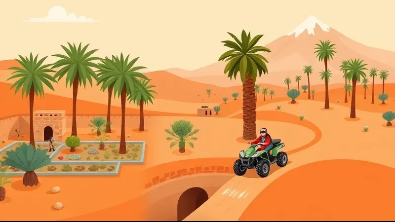
Today the grove sits about a twenty-minute drive from Jemaa el-Fna, traffic depending. What you find there now is a mixed zone rather than a farming belt: palm plots of very uneven density, olive and fruit orchards, working farms and Berber hamlets, alongside luxury hotels, golf courses, private villas and activity bases running quad, buggy, camel and horse tours.
Its exact area is disputed, because different sources draw the boundary in different places — but on any definition it has shrunk from its historic extent, and the trees you see are a mix of old survivors and recent replanting.
Who created the palm grove, and why was it planted here?
The Almoravids created it, deliberately, as an irrigated agricultural belt for their new capital. Marrakech was founded on open plain with no river running through it. A city of that ambition needed grain, dates, fruit, fodder and shade, and it needed them close enough to be defensible. The palm grove was infrastructure before it was scenery.
A popular story says the grove sprouted by accident, from date stones spat out by Almoravid soldiers camped on the plain. It is a good story and you will hear it from guides — but it is folklore, not documented history. The real version is less charming and more impressive: the land was surveyed, planted with selected stock, and tied into a water system built specifically to keep it alive.
Every dynasty that followed added to the same hydraulic and garden landscape. The Almohads laid out the great walled gardens; the Saadians and later the Alaouites maintained, extended and rebuilt basins, channels and orchards. That continuity is part of why UNESCO inscribed the Medina of Marrakesh on the World Heritage List — the historic city and its water and garden systems are read as one achievement, not separate ones.
How did the khettara irrigation system make the Palmeraie possible?
Gravity did the work. A khettara — the Moroccan equivalent of the Persian qanat — is a gently sloping tunnel dug underground, sometimes for kilometres, punctuated at intervals by vertical shafts used for digging and maintenance. It taps the alluvial aquifer of the Haouz plain, which is recharged by snowmelt off the High Atlas, and moves that water downhill to the surface with no pumping and almost no evaporation loss.
Building one was slow, dangerous, communal work. Maintaining one was permanent work. In exchange, a single khettara could support a whole chain of plots downstream, and that reliability is what allowed the layered oasis agriculture the grove was designed around: date palms forming the canopy, fruit trees such as figs, pomegranates and olives beneath them, and cereals, fodder and vegetables at ground level in the shade.
The engineering is documented in detail in Dale R. Lightfoot's research on Moroccan khettara, and the High Atlas Foundation has written on what the system still means in the Haouz region today. Understanding the khettara is the key to understanding everything that went wrong later.
Why is the Palmeraie smaller and drier than it used to be?
Because four separate pressures hit the same landscape, and each one made the others worse.
- The khettara network collapsed. Motorised borehole pumping is faster, cheaper per farmer and needs no collective maintenance — but it draws the water table down. Once the table drops below the level of a gravity-fed tunnel, that tunnel runs dry permanently. The technology that replaced the khettara is also what killed it.
- Bayoud disease. Fusarium oxysporum f. sp. albedinis is a soil-borne fungus that causes a fatal vascular wilt in date palms. First recorded in southern Morocco, it spread through North African groves across the twentieth century and hit prized cultivars such as Mejhoul and Bou Feggous hardest — precisely the varieties farmers most wanted to keep. The EPPO datasheet sets out the pathogen and its distribution.
- Urban expansion. Marrakech grew outward into former agricultural plots. Peer-reviewed work on the grove consistently identifies urbanisation as a leading driver of its degradation: once a plot is built on, it does not come back.
- Recurrent drought. The Tensift basin, managed by the Agence du Bassin Hydraulique du Tensift, has faced repeated dry cycles. Less recharge from the Atlas means less water in the aquifer for everyone drawing on it.
None of this is dramatic in isolation. Together, over decades, it turned a productive agro-system into a fragmented one.
What is being done to protect and replant the palm grove?
There is a real conservation record, and it is worth stating plainly rather than dismissively. A safeguarding and development programme for the palm grove was placed under the Fondation Mohammed VI pour la Protection de l'Environnement, chaired by Princess Lalla Hasnaa. Its work has included clearing and cleaning the site, pruning and rehabilitating existing plots, establishing a dedicated nursery, and large-scale replanting of young palms — alongside reinforcement of the legal and urban-planning protections covering the zone.
In parallel, INRA Morocco has long-running research on Bayoud-resistant date palm selections, which matters because replanting susceptible cultivars into infected soil simply repeats the problem. Treated wastewater is also used to irrigate green space around the city, reducing pressure on the aquifer.
The honest caveat: a replanted grove is not a restored oasis. Young palms take many years to reach productive maturity, and planting trees does not by itself rebuild the khettara network, the layered under-canopy cropping, or the farming households whose labour maintained both. Density is recovering in places. The agro-system largely is not.
How did tourism change the Palmeraie?
Tourism converted the grove from a place that produced food into a place that hosts visitors. In recent decades, luxury hotels, golf courses, private villas and riads spread through the plots; a loop road, the Circuit de la Palmeraie, made the zone easy to drive; and camel rides, quad and buggy circuits and horse riding concentrated on the tracks between properties.
The balanced reading is this: the agricultural economics of the grove had already collapsed before tourism arrived at scale. Land that no longer paid as farmland found a buyer as leisure land, and that brought income and jobs to the zone. It also increased water demand, accelerated conversion of plots, and put steady vehicle traffic onto unpaved tracks running past homes.
One practical consequence for visitors: land use varies plot by plot, and so do operators. Two tours sold under the same "Palmeraie quad" label can cover very different ground — one mostly rural tracks and village lanes, another largely open scrub near hotel perimeters. That is the main reason reviews of the same-sounding experience diverge so sharply.
What can you actually see in the Palmeraie today?
A working, uneven, semi-rural landscape — not a Sahara-style oasis. Set expectations honestly before you book, because this is where disappointment usually comes from.
Expect dry sandy and stony tracks, clusters of date palms whose density changes plot to plot, olive and fruit orchards, low mud-brick walls, irrigation ditches, farms in use, Berber villages with children and livestock, hotel fences, and construction on the fringes. On clear days the High Atlas is visible to the south. There will be dust, and in a dry spell there will be a lot of it.
The sectors furthest from the ring road, on the northeastern and eastern edges, feel most rural and least built-up. Closer in, the grove reads as suburban with palms. If your mental image is rolling dunes, that landscape is not here — and it is not in Agafay either.
How does the Palmeraie compare with Agafay and the Jbilat for a quad tour?
The Palmeraie is the closest, flattest and most beginner-friendly of the three, with the shortest transfer and the most shade. Agafay is the dramatic-landscape option and costs you more time in the van.
| | Palmeraie | Agafay | Jbilat | |---|---|---|---| | Location | Northern edge of Marrakech | 30–40 km southwest | Hills north of the city | | Transfer | About 20 minutes | 45–60 minutes | Usually combined with the Palmeraie in one circuit | | Terrain | Flat sandy and stony tracks, village lanes | Rocky, "lunar" stone desert with rolling hills | Arid rocky hills, wide open tracks | | Shade | Some, under palm clusters | None | None | | Scenery | Palms, farms, villages | Open desert, Atlas views | Bare hills, long sightlines | | Best for | First-timers, short time budget, families | Landscape and photography | Riders wanting open space |
One honest correction to a common assumption: Agafay is not the Sahara. It is a stone and clay desert, not sand dunes, and the nearest true dune fields are a long way south. If you want to see the difference laid out side by side, the Agafay vs Palmeraie comparison goes through it in detail.
Standard ride blocks in all three zones are one hour and two hours. Live prices, exact durations, availability and traveller ratings are pulled from the GetYourGuide widgets on each tour page — they change constantly, so we never quote them in the editorial text. Check them on the relevant tour page before you decide.
When is the best time of year to visit the palm grove?
Spring and autumn, when daytime temperatures generally sit in the 20–30 °C range. Those are the windows where a daytime ride is comfortable rather than something to endure.
Summer is the honest problem. Average July highs run around 37–38 °C, and Marrakech has recorded 49.6 °C. Operators respond by scheduling summer departures early in the morning or in the golden hour before sunset, and those slots are genuinely fine — but a midday ride in July is a bad idea whatever the tour page says. Winter days are mild and pleasant for riding; mornings and evenings are cold on a moving quad, so bring a layer.
Rain is concentrated in the cooler months and rarely disrupts a tour for long, though it does cut the dust considerably. The date harvest in early autumn is when the grove is at its most agriculturally active, and the plots look their best. For current conditions and forecasts, the Direction Générale de la Météorologie is the official Moroccan source.
How do you visit the Palmeraie responsibly?
By treating it as what it is: inhabited private farmland that happens to be beautiful. None of this is complicated, and all of it is checkable before you book.
- Stay on existing tracks. Cutting new lines through plots damages irrigation ditches and root zones. A guide who lets the group fan out across farmland is telling you something.
- Remember most of the grove is privately owned and worked by families who live there. You are riding past homes, not through a park.
- Ask before photographing people. This is normal courtesy in Morocco and is usually met warmly.
- Choose operators that brief on noise and dust near villages and slow the group down through inhabited stretches. Ask directly — it is a fair question.
- Carry water and take your litter out. There are no bins on the tracks.
- Apply the same scrutiny to camel and horse operations. Look at body condition, saddle fit, shade and rest between rides, and walk away if it looks wrong. If you are weighing the combined format, our notes on quad with camel versus quad only cover what changes.
For licensed operators and official tourism information, the Office National Marocain du Tourisme is the reference point.
What should you know before booking a Palmeraie tour?
Budget more time than the ride length suggests, and check what your insurance actually covers.
- Pickup from hotels and riads in the medina, Gueliz and Hivernage is usually included, with a transfer of roughly twenty minutes each way.
- Ride time is typically one to two hours, and the realistic door-to-door commitment is about 2.5–3 hours including transfers, briefing and the tea stop.
- No driving licence is required for tourist quad tours, because they run on private tracks. Moroccan law does require helmets for both driver and passenger.
- Minimum driving age is typically 16, with 16- and 17-year-olds accompanied by an adult; younger children ride as passengers on double quads. Exact rules vary by operator.
- Equipment: operators provide a helmet and goggles, and usually gloves. Insurance coverage varies significantly — confirm what is included and what the excess is before you pay.
- Wear closed shoes, long sleeves and long trousers. The dust is real and it gets everywhere. Sunglasses under the goggles help.
- A mint tea stop is close to universal on Palmeraie circuits, often at a Berber house or small farm.
If you want the shortest, gentlest introduction, the Palmeraie quad with tea break is the standard format; to add the open hills to the north in one outing, look at the Palmeraie and Jbilat circuit. Prices and availability appear live on those pages.
Frequently asked questions
Is the Palmeraie of Marrakech natural or man-made?
It is man-made. The palm grove was planted and irrigated during the Almoravid period as an agricultural belt to supply the newly founded city of Marrakech. It has been maintained, damaged and replanted by successive dynasties and programmes ever since, but it has never been a naturally occurring desert oasis.
What is a khettara?
A khettara is a traditional underground irrigation tunnel, the Moroccan equivalent of the Persian qanat. Gently sloping and reached by vertical maintenance shafts, it taps the aquifer of the Haouz plain and carries water downhill by gravity alone, with almost no evaporation loss. Borehole pumping lowered the water table and left many khettaras dry.
Why do some palms in the Palmeraie look dead?
Several reasons overlap. Bayoud disease, caused by a soil-borne fungus, kills date palms outright and has affected North African groves for decades. Falling groundwater levels, drought and abandoned plots stress the rest. Some brown-looking palms are simply unpruned rather than dead.
Is the Palmeraie better than Agafay for a quad tour?
Neither is better — they suit different priorities. The Palmeraie is about twenty minutes away, flat, partly shaded and the easiest for beginners. Agafay is 30–40 km southwest with a 45–60 minute transfer, treeless and rocky, with open desert views. Choose the Palmeraie for time efficiency, Agafay for landscape.
Do I need a driving licence to ride a quad in the Palmeraie?
No. Tourist quad tours run on private tracks, so no driving licence is required. Moroccan law does require helmets for both the driver and any passenger. Operators typically set a minimum driving age of 16, with 16- and 17-year-olds accompanied by an adult, and younger children riding as passengers.
Sources
All links checked on 16 August 2026.
- UNESCO World Heritage Centre — Medina of Marrakesh (ref. 331)
- Fondation Mohammed VI pour la Protection de l'Environnement — Safeguarding and development of the Marrakech palm grove
- Dale R. Lightfoot, "Moroccan Khettara: Traditional Irrigation and Progressive Desiccation" (PDF)
- High Atlas Foundation — "Khettara": The Past and Present Treasure in the Haouz Region
- EPPO Global Database — Fusarium oxysporum f. sp. albedinis (Bayoud disease of date palm)
- INRA Maroc — Institut National de la Recherche Agronomique
- Agence du Bassin Hydraulique du Tensift
- Direction Générale de la Météorologie du Maroc
- Office National Marocain du Tourisme